un arcipelago meraviglioso nel centro del Mediterraneo
"The Aeolian Islands provide an outstanding record of volcanic island-building and destruction, and ongoing volcanic phenomena. Studied since at least the 18th century, the islands have provided the science of vulcanology with examples of two types of eruption (Vulcanian and Strombolian) and thus have featured prominently in the education of geologists for more than 200 years. The site continues to enrich the field of vulcanology." (Unesco World heritage Centre)Lipari
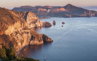
This isle is the largest of the Aeolian Islands, 36,7 sq km. Its volcanic nature is revealed by its dominating colours: the white of the pumice-stones and the black of the obsidian. Thousands of years ago obsidian represented the islands principal export with the continent because it was extremely suitable for the manufacturing of sharp tools and arms. The volcanic phenomenon can also be observed in the island's thermal springs, in its solfataras and in its 12 volcanic systems converging towards the 602 metres of Monte Chirica (although this is not the only mountain of Lipari). The castle of Meligunte, which overlooks the town and port, houses within its walls one of the finest archaeological museums in Europe and is also the site of the impressive Norman-style cathedral. Dotted elsewhere on the island are countless archaeological and historical sites to satisfy the most eager explorers. The island has also spectacular beaches and breathtaking ragged coasts whose walls rise precipitously from below the sea. Formerly volcanic, Lipari is now the chief source of pumice-stone that gives to the sea a peculiar colour that goes from white to light blue, actually, the most famous beach is called “Spiagge Bianche” (White Beaches). Besides the town of Lipari there are four more villages on the island: Canneto, Acquacalda, Quattropiani and Piano Conte.
Vulcano
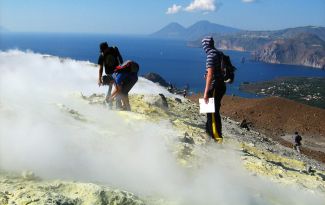
It is only half mile from Lipari and 10 minutes with the hydrofoil. It was once called 'Hierà" (the sacred), but also "Termessa" or "Terrasia". Today it is famous for the baths in the warm waters of its submarine springs. This 21 sq km, 500 metre high (Monte Aria) isle is the closest Aeolian island to the Sicilian coast. Its name is a clear description of its geography: a land of lava and fumaroles, yellow sulphur rocks and black sands all worth a visit. There are three volcanoes on the island: the first extinguished since the prehistoric age; the second is Vulcanello (123 metres high and dormant since 183 B.C.); the last is “Gran Catere” (only the fumaroles are still active). The nicest beaches are Porto Ponente and Porto Levante and Spiaggia dell’Asino (Gelso). Click here...
Salina
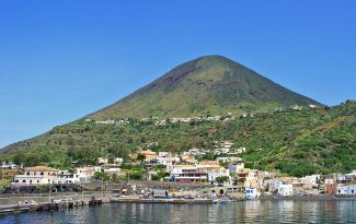
This isle is the second largest Aeolian island (26.8 km2). It was named after the little salted lake of Lingua lying at the south-eastern tip of Salina where the inhabitants once used to gather the salt needed to preserve capers and fish. This centrally located isle, lying two miles from Lipari, is the only Aeolian island (out of seven) covered with blooming vegetation. The cultivated fields are fed by natural springs of fresh water which allow marvelous Malvasia grapes to grow (from which the very famous dessert wine is produced) as well as capers. It is also the island with the highest peaks such as the three volcanoes (all extinct) that originated it: Monte Fossa delle Felci (962 m), which is partially covered by one of the most beautiful strawberry tree woods of the entire Mediterranean; Monte dei Porri (860 m); and Monte Rivi (850 m). Besides the three villages of Santa Marina Salina (the biggest), Malfa and Leni there are also five hamlets: Lingua, Rinella, Valdichiesa, Pollara and Torricella. Salina, too, can take pride in its past during the Bronze Age, which is demonstrated by a grave, found in Malfa, dating back to the third millennium B.C. The remains are exhibited in the Museum of Lipari.
Panarea
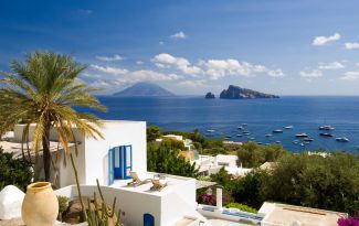
The smallest Aeolian island is highly admired by élite tourism. The main village, Contrada San Pietro, consists of a group of white houses clustered along the eastern side of the island. The other two villages north and south of San Pietro are Dittella and Drauto. The only practicable roads join the centre with Punta Calcara. The island of Panarea was inhabited since Neolithic Age. On the promontory of Capo Milazzese, to the South-East extremity, is developed a village of huts going back to the middle Bronze Age (1400-1270 B.C.).This prehistoric village can be reached from the beach of San Pietro in an hours walk. A boat tour is recommended to the nearby small islands of Basiluzzo, Dattilo and Lisca Bianca, to the Scoglio Bottaro (with its underwater "fumaroles"), and to the crags Lisca Nera and Le Formiche. A stop is due at the beautiful small bay Cala Junco.
Alicudi
This island 5.2 sq km, is an extinct volcano that rises out of the sea to reach the summit of Monte Filo dell'Arpa (657 m; also known as Timpone della Montagnola). This is the western-most of the inhabited Aeolian islands and lies about 67 miles from Milazzo. It was once called "Ericusa", because of the heather that covers with a pink blanket its lavic surface in spring- time. It is not part of the mass tourism circuit and the only landing area is near the Scoglio della Palomba. The boat tour along the 4 kilometres of the island's coast slowly exposes enchanting spots and peculiar red and black rocks separating the little beaches from each other. The stair-shaped eastern side is really peculiar. You can see the church of San Bartolomeo rising above the houses of Alicudi and offering a wide panorama
Filicudi
Once it was called 'Phoenicusa': "rich in ferns", and a major area of the island is still covered with this type of vegetation. This island, measuring just under 10 sq km, lies 9 miles from Alicudi and 19 miles from Lipari. The highest peaks were once eruptive mouths: Fossa delle Felci (774 m) which is the oldest; Montagnola (333 m) which is probably the most recent; and Torrione (280 m). This ideal holiday island, light-years away from traffic and noise has two villages lying on a small peninsula stretching out towards the south: Filicudi Porto and Pecorini a Mare. The remains of prehistoric settlements from the Bronze Age have been found here. Subsequent settlements were also built here, probably for defence requirements and deserves a visit. A boat tour is highly recommended to “La Grotta del Bue Marino”, a cave which once used to house monk seals and a legend says that a monster had its refuge.
Stromboli
The most northern of the Aeolian Islands archipelago, is 12.6 sq km, his inhabitants are about 500. Stromboli is exactly a 924 metre high lava mountain (Serra Vancori) which drops abruptly down to 2000 metres below sea-level and is Europe's biggest active volcano after Etna. During the night, the glittering "sciara del fuoco” (the red-hot flow descending towards the sea) can be seen from the boats and from Panarea. The white houses of the little village create a unique contrast with the black lava background dotted with dark-green bushes. On the western side of the island, named by local inhabitans "Pertuso", there's the village of Ginostra, characterized by the smallest harbour of the world... just one boat at a time can tie up! Here hydrofoils stop away from the harbour and a smaller boat takes visitors to the land.
The other harbour of Stromboli Island is "Scari", undoubtedly much more comfortable. It's located in the village of San Vincenzo in the east side of the island.
From San Vincenzo to Piscità it's a succession of extraordinary coves and beautiful black sand beaches. From the terrace in front of the church of San Vincenzo it is visible "Strombolicchio", a great basaltic volcanic reef raising from the sea up to 50m, at just 1 km from the beach.


